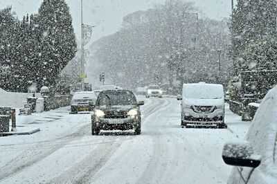
New weather maps are showing when the UK is likely to be hit snow blizzards again.
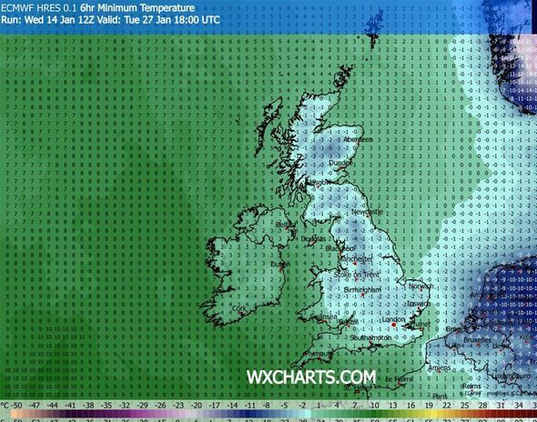
Forecast issued yesterday (January 14) showed more snow coming towards the UK by the end of this month, and maps from WXCharts.com say the UK is likely to be hit again around Tuesday, January 27, when a 400-mile blizzard will approach the country.
According to these maps, snow will hit the country from the north of Scotland to as far south as London, with the east of England likely to be hit too. Part of Wales and the south west of England, including Bristol, could see some snow as well. The north west of England and Scotland could be covered by up to 20cm of snow.
This is due to a Siberian chill which can reach the country, including the south of England and London, towards the end of this month.
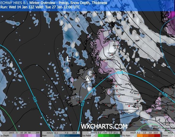
Scotland could again be covered by up to 50cm of snow in some northern areas, but the latest maps show some areas around Dundee and Aberdeen could see up to 77cm of snow. The north of England, especially Newcastle, could be covered by up to 33cm of snow, while the rest of the country could see up to 5cm (London area). Temperatures, from Scotland to the south of England, could drop a few degrees below 0 again.
A Met Office long-range forecast is also suggesting a "potential transition to colder weather" which could "also increase the chance of snow across parts of the country".
This forecast covers a period going from January 20 to January 29, the Met Office said. The full forecast reads: "Throughout this period, the UK will see a battle between Atlantic weather systems attempting to arrive from the west while high pressure and colder conditions attempt to exert some influence from the east.
"Initially, milder Atlantic air is expected to dominate. This should maintain often cloudy, changeable conditions with showers or longer spells of rain for most. The wettest weather is in the western parts of the country, drier in the east. Temperatures overall likely to be around average, with some night frosts in clearer areas.
"Later in the period, there is an increased chance that conditions will turn colder. This aspect of the forecast is still somewhat uncertain, but the potential transition to colder weather also increases the chance of snow across parts of the country."
Portsmouth
Chichester
Brighton
Winchester
Canterbury
London
Westminster
Southend-on-Sea
Chelmsford
St Albans
Colchester
Cambridge
Milton Keynes
Ely
Peterborough
Norwich
Coventry
Leicester
Birmingham
Wolverhampton
Derby
Stoke-on-Trent
Nottingham
Lincoln
Lichfield
Sheffield
Salford
Chester
Doncaster
Wakefield
Hull
Leeds
Manchester
Liverpool
Preston
Lancaster
Bradford
York
Ripon
Durham
Sunderland
Newcastle
Carlisle
Edinburgh
Glasgow
Dunfermline
Stirling
Perth
Dundee
Aberdeen
Inverness
Contact to : xlf550402@gmail.com
Copyright © boyuanhulian 2020 - 2023. All Right Reserved.