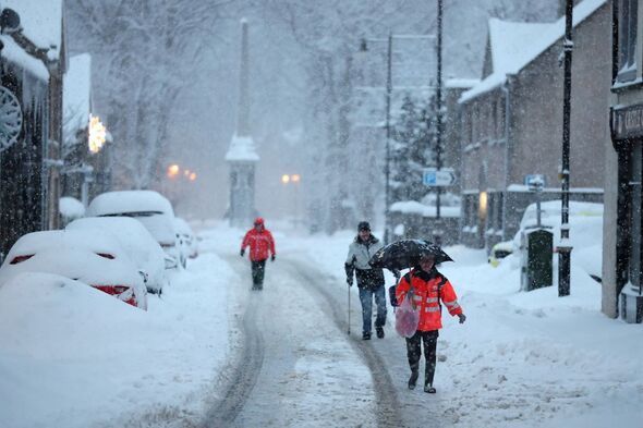
The latest weather maps show that snow will make its way to the UK, with a chilly -7C to be seen in some areas. The snow comes after many parts of the country have already seen chilly wintery conditions at the start of 2026.
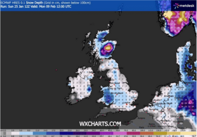
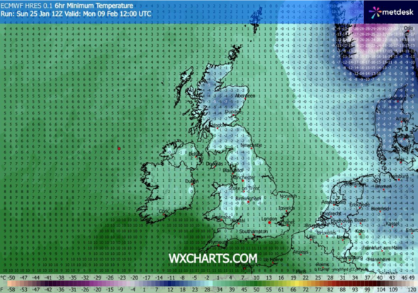
Maps from forecaster WXCHARTS show that on Monday, February 9, at 12 noon, freezing temperatures will sweep Britain. Lows of -7C will make their way to Scotland, with the coldest temperatures to be in Cairngorms National Park. In the north of England and down towards the midlands, temperatures will sit at around 0C to -2C. Around 95% of the country looks to be covered with snow.
As for the south of England, things will be warmer, with highs of 7C in Devon. Snow maps show snow will cover most of the UK, approximately 75%, with the exception of the south west, which will be the only region to miss out.
In south Wales, there will be around 20cm of snow, with between 2cm and 11cm in the rest of England. Northern Ireland will see around 2cm while Scotland will see the highest levels of snow at around 130cm in some areas.
Separately, a Met Office weather forecast says: "Weather systems from the Atlantic will continue to attempt to push in from the west, but tending to stall in the vicinity of the UK as they encounter high pressure to the north and northeast.
"As a result, further spells of rain or showers as well as strong winds are expected at times.
"Rain may be heavy and persistent, especially in the south and west. Whilst mild conditions are expected to encroach into the south and southwest at times, cold air is likely to be positioned to the northeast, bringing wintry showers at times.
"Where fronts from the southwest do reach the cold air towards the northeast, there is the risk of some snow, most likely across hills, but perhaps extending to lower areas at times."
Contact to : xlf550402@gmail.com
Copyright © boyuanhulian 2020 - 2023. All Right Reserved.