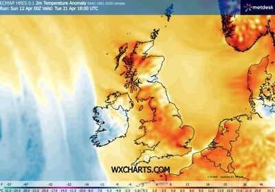
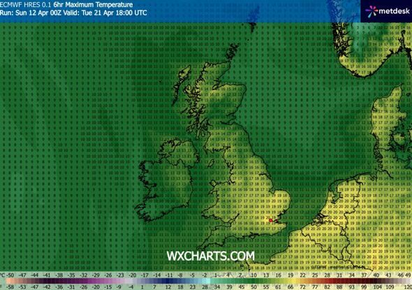
Britain could be baking in 20C temperatures in the next fortnight as warm weather looks set to blast much of England with two main areas enjoying the highest spike. According to forecast maps from WXCharts the sunshine will be beaming down on the nation on Monday April 20 and Tuesday April 21.
On both days much of East Anglia, Essex, Kent, East and West Sussex, Greater London, Oxfordshire and the Home Counties can expect to see the mercury easily hit 18 or 19C. But on Tuesday April 21 both London and Cambridgeshire are forecast to enjoy a 20C spike making them the hottest places in the country.
The southeast of England is predicted to see the best of the sunny conditions, with temperatures in the Midlands and the North hovering around the late teens. Wales and Northern Ireland look set to be cooler at around 13 to 14C. In Scotland the mercury may struggle to get past 11 or 12C around Edinburgh or Glasgow, but unusually the Highlands may be a bit warmer in the region of 15 or 16C.
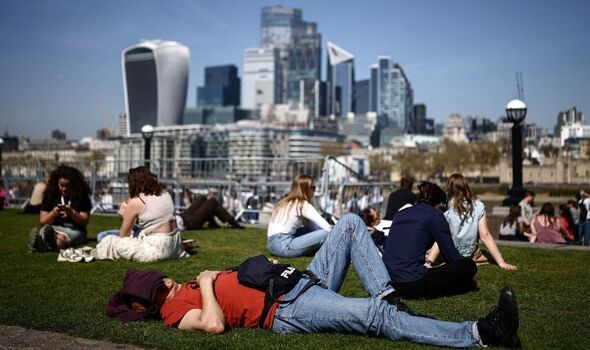
April has already seen some above average temperatures for the time of year with London recording hotter readings than holiday destinations such as Ibiza, Rome and Marrakech on Wednesday April 8. The Met Office said it was the hottest day recorded in the first half of April since 1946. Temperatures reached a high of 26.6C in Kew Gardens, south west London, the forecaster said.
The record temperature is the highest recorded in the United Kingdom during the first half of April in the last 80 years.
Looking ahead to later this month covering April 20 and 21, the Met Office forecast stated "temperatures will likely be near or slightly above average overall".
It added: "Changeable at the start of this period with low pressure to the west or northwest of the UK.
"This will bring showers or longer spells of rain at times, heaviest and most persistent in the northwest, together with some strong winds. The southeast is likely to be driest and brightest.
"Later in this period, conditions may become drier and more settled, perhaps more especially in the north or northwest, with the south possibly becoming the focus for showers or longer spells of rain."
This Evening and Tonight:
Many areas will become dry with clear spells developing fairly widely, although showers will linger across northern Scotland. Turning chilly as winds ease allowing a patchy rural frost and also some mist and fog.
Monday:
A dry start for many, with showers initially in the northwest and far southwest. Showers will soon develop widely, these will be locally heavy and carry a risk of thunder.
Outlook for Tuesday to Thursday:
Fine for many on Tuesday, but wet and windy weather arriving in the west, edging eastwards across much of the country on Wednesday. Drier and brighter on Thursday. Turning warmer.
Contact to : xlf550402@gmail.com
Copyright © boyuanhulian 2020 - 2023. All Right Reserved.