Bengaluru Karnataka rainfall
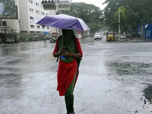
Bengaluru is likely to witness thunderstorms with rainfall on Monday, May 18, according to the India Meteorological Department (IMD). The temperatures in the city will range between a minimum of 23°C and a maximum of 33°C. Humidity levels will vary between 45 percent and 70 percent, however, no weather warnings have been issued for the day.
The weather office has issued a yellow alert for Bengaluru and most parts of interior Karnataka for the next three days. An orange alert has been sounded for parts of south interior Karnataka for the next 24 hours, according to the IMD forecast.
ALSO READ: Himanta Biswa Sarma’s son Nandil Biswa Sarma completes Ironman Vietnam
Bangalore is expected to see intense rainfall with thunderstorms on Wednesday, May 20, as the IMD has predicted "Rain or Thundershowers with strong gusty winds". The weather forecasting agency has also predicted yellow alert for Bengaluru. The IMD has indicated continued pre-monsoon activity with thunderstorm possibilities over Karnataka in the coming days.
According to IMD, a low-pressure area has formed over the southwest and adjoining west-central Bay of Bengal. In addition, an upper-air cyclonic circulation is active over north coastal Tamil Nadu and nearby areas, while another cyclonic circulation has developed over northeast Vidarbha and surrounding regions.
Puviarasan said these weather systems are collectively driving widespread thunder showers and are also helping the southwest monsoon advance further.
IMD officials added that conditions are becoming favourable for the southwest monsoon to move into parts of the southeast Arabian Sea, southwest and southeast Bay of Bengal, the remaining Andaman Islands and Andaman Sea, and parts of the east-central Bay of Bengal over the next four days.
Rainfall data from IMD shows that Bengaluru city has received 175 mm of rainfall since March 1, which is 70 mm above normal. Meanwhile, the HAL airport area recorded 54 mm rainfall, nearly 48 mm below the seasonal average.
The weather office has issued a yellow alert for Bengaluru and most parts of interior Karnataka for the next three days. An orange alert has been sounded for parts of south interior Karnataka for the next 24 hours, according to the IMD forecast.
ALSO READ: Himanta Biswa Sarma’s son Nandil Biswa Sarma completes Ironman Vietnam
Bengaluru weather forecast
Bengaluru is likely to receive thunderstorms with rainfall on Monday, May 18. The weather in the city on Tuesday, May 19, is likely to remain the same with a high possibility of rainfall with thunderstorms.Bangalore is expected to see intense rainfall with thunderstorms on Wednesday, May 20, as the IMD has predicted "Rain or Thundershowers with strong gusty winds". The weather forecasting agency has also predicted yellow alert for Bengaluru. The IMD has indicated continued pre-monsoon activity with thunderstorm possibilities over Karnataka in the coming days.
Rainfall in Karnataka for few days
The IMD has forecast rainfall for Chitradurga, Davangere, Shivamogga, Chikkamagaluru, Kodagu, Mysuru and Chamarajanagar district for the next two days and also advised residents to remain alert. Thunderstorms and showers have also been forecast for Bengaluru, Kolar, Chikkaballapur, Tumakuru, Mandya, Hassan, Dakshina Kannada, Udupi, Uttara Kannada, Haveri, Vijayanagara, Vijayapura, Raichur, Yadgir, Koppal, Gadag, Dharwad and Belagavi districts, the IMD said.Why is it raining in Karnataka now?
Explaining the recent spell of heavy rain and thunderstorms, IMD Bengaluru Director N Puviarasan told The New Indian Express that multiple weather systems developing over the region are triggering intense pre-monsoon showers. He noted that sudden thunderstorms and rising temperatures are common during the pre-monsoon season, but people should stay alert as strong winds are also likely.According to IMD, a low-pressure area has formed over the southwest and adjoining west-central Bay of Bengal. In addition, an upper-air cyclonic circulation is active over north coastal Tamil Nadu and nearby areas, while another cyclonic circulation has developed over northeast Vidarbha and surrounding regions.
Puviarasan said these weather systems are collectively driving widespread thunder showers and are also helping the southwest monsoon advance further.
IMD officials added that conditions are becoming favourable for the southwest monsoon to move into parts of the southeast Arabian Sea, southwest and southeast Bay of Bengal, the remaining Andaman Islands and Andaman Sea, and parts of the east-central Bay of Bengal over the next four days.
Rainfall data from IMD shows that Bengaluru city has received 175 mm of rainfall since March 1, which is 70 mm above normal. Meanwhile, the HAL airport area recorded 54 mm rainfall, nearly 48 mm below the seasonal average.