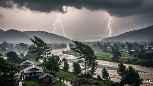
A major change in seasonal activities is being recorded across the country. According to the India Meteorological Department (IMD), the southwest monsoon has formally departed from most parts of northwest and central India. Dry northwesterly winds have now established over Rajasthan, Punjab, Haryana, Delhi-NCR and western Uttar Pradesh. However, amid this withdrawal of monsoon, the weather pattern has suddenly changed in the eastern, northeastern and southern peninsular states of the country. Due to active weather systems over the Bay of Bengal and Arabian Sea, meteorologists have issued a new alert of strong winds, thunderstorms and heavy to very heavy rain in many states during October 4 to 6.
The maximum effect of moist winds coming from the Bay of Bengal is being seen in Eastern and North-Eastern India. The weather may remain extremely challenging in these states during the next 72 hours:
- Assam and Meghalaya: There is a possibility of torrential rain in many hilly and plain areas of these two states between October 4 and 6. The Meteorological Department has issued a warning regarding lightning and sudden waterlogging here.
- Arunachal Pradesh, Nagaland, Manipur and Tripura: Due to continuous accumulation of moisture on the hill slopes, there is a possibility of landslides and overflow of rivers and streams. Tourists and local residents have been asked to exercise caution while traveling on sensitive roads.
- Sub-Himalayan West Bengal and Sikkim: There is a danger of water level rising due to moderate to heavy rains in the catchment areas of rivers like Teesta and Jaldhaka.
Seasonal disturbances have intensified due to cyclonic circulation and coastal trough in the southern peninsula. Widespread rainfall is forecast over southern states from October 4 to 6:
- Kerala and Mahe: Yellow and orange alert has been issued for heavy rainfall along with loud thunder in the districts adjacent to the Western Ghats.
- Coastal and Southern Interior Karnataka: There is a possibility of intermittent heavy rain in Bengaluru, Mysuru and coastal districts like Dakshina Kannada and Udupi.
- Tamil Nadu, Puducherry and Karaikal: Light to moderate rain with strong thunder and lightning may be recorded in many interior and coastal areas in the evening.
While some parts of the country are facing heavy rains, the weather in the northern and western states has become completely clear and dry:
- Delhi, UP and Bihar: The sky will be clear and there will be bright sunshine in the national capital Delhi and the plains of Uttar Pradesh. The maximum temperature of the day will remain between 33 to 35 degrees Celsius.
- The sound of pink cold: After the departure of monsoon, the moisture level in the air has decreased. Due to this, minimum night temperatures are falling by 2 to 3 degrees Celsius in Rajasthan, Punjab, Haryana and Western Uttar Pradesh, due to which a feeling of light pink cold has started in the morning and evening.
- Madhya Pradesh and Gujarat: Monsoon clouds have completely dispersed from these states too and there is no active rain alert in the coming days.
The Meteorological Department has asked the farmers of the states where there has been an alert of heavy rain from October 4 to 6, to take special precautions:
- Harvesting and Storage: Farmers who have harvested Kharif crops (paddy, oilseeds) should keep the harvested produce in safe and dry places instead of leaving it in open fields so that the crop does not get spoiled due to moisture.
- Protection from lightning: Farmers and common people working in the fields should avoid taking shelter in open fields, under tall trees and electric poles during times of rain and strong thunder.
- road safety: People driving in mountainous areas should avoid long journeys at night due to the possibility of slippage and landslides.
Contact to : xlf550402@gmail.com
Copyright © boyuanhulian 2020 - 2023. All Right Reserved.