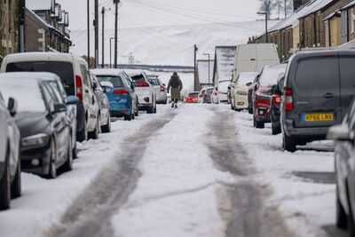
Snow is likely to batter parts of the UK in the days ahead as the Met Office names the regions that will experience the wintry conditions. According to the weather experts, a snap of cold air will impact several areas on Sunday (January 25), turning the UK weather into a "battleground".
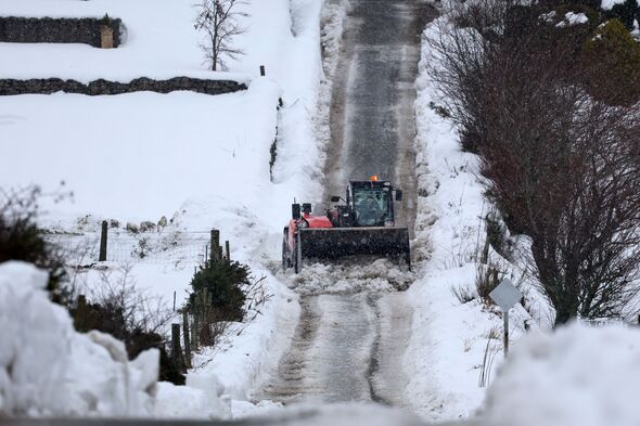
Meteorologists say that later this month, strong Atlantic storms will push in from the west and collide with stubborn high pressure sitting over the north. The clash is expected to create colder, more unstable conditions, increasing the likelihood of snow. Because of this setup, parts of Scotland and northern England could see heavy snowfall by the end of the month, potentially leading to disruptive winter weather if the pattern continues.

Sharing its long-range weather forecast for the coming days, the Met Office said that the conditions are likely to turn "colder".
It explained: "Weather systems moving in from the Atlantic will continue to attempt to push in from the west, but tending to stall in the vicinity of the UK as they encounter high pressure to the north and northeast.
"As a result, further spells of rain or showers are likely at times. These may be heavy and persistent, especially in the south and west, with the best of any drier interludes in the far north and northeast.
"Whilst mild conditions are expected to encroach into the south and southwest at times, it is likely to turn somewhat colder through this period, bringing the risk of some snow showers, most likely across hills in Scotland and northern England."
Nick Finnis, a meteorologist with Netweather.tv, wrote in his blog: "A battleground looks to play out in the days ahead across the UK between a large high pressure system extending west from Siberia and a queue of lows coming in from the west, thanks to an increasingly powerful jet stream moving east out of the Eastern Seaboard of North America across the North Atlantic and on into western Europe.
"High pressure extending west over NE Europe this week will be too far away to prevent low pressure systems moving in off the Atlantic close to the southwest before being forced north or northwest across Ireland due to the blocking high pressure to the east and northeast over Scandinavia. Into the weekend, and the battleground may shift.
This week, the Atlantic has the upper hand, bringing relatively mild, wet, and windy conditions for many. But as we head into Sunday, the balance looks to shift increasingly in favour of blocking high pressure to the northeast, asserting more influence further west across the North Sea and over northern UK.
"This extension of high pressure from Scandinavia will tend to force further lows moving towards the UK southeastwards into France and Spain into early next week.
"This may allow cold air to flood west over the North Sea from Scandinavia, initially the coldest of this air flooding across the north and northeast on Sunday, but perhaps cold air flooding across all areas on Monday, perhaps cold enough for snow too, but uncertainty over this."