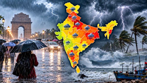
India Weather Update, October 15, 2026: Even as the southwest monsoon continues its withdrawal from India, unsettled weather conditions are expected to affect several parts of the country. According to the weather report, rain, thunderstorms, lightning and strong winds could occur across parts of 22 states and Union Territories, potentially disrupting normal activities.
Some areas of northern India may experience particularly strong winds, with gusts reportedly reaching up to 75 kilometres per hour. Meanwhile, mountainous regions could face an increased risk of landslides during intense rainfall, while fishermen in affected coastal areas have been advised to pay attention to marine weather warnings.
The forecast indicates that Delhi, Uttar Pradesh, Rajasthan, Bihar, Madhya Pradesh and several southern and northeastern states may experience changing weather conditions on October 15.
However, rainfall intensity and storm activity are expected to vary considerably between districts. A statewide mention does not mean every district will receive heavy rainfall.
Why Is the Weather Changing Across India?
The reported weather developments are associated with several atmospheric systems operating over different parts of the country.
Although the southwest monsoon is retreating, moisture availability and regional weather disturbances can still produce rainfall and thunderstorms.
The report identifies the following atmospheric features:
1. Western Disturbance Near Jammu
A cyclonic circulation associated with a western disturbance has been reported over the Jammu region in the lower atmosphere.
Such systems can influence cloud formation, rainfall and temperature patterns across northern India.
2. Cyclonic Circulation Over Haryana
Another circulation system has been identified around northern Haryana and neighbouring areas.
Its interaction with surrounding atmospheric conditions may contribute to thunderstorms and gusty winds in parts of northern India.
3. Trough Extending Towards the Bay of Bengal
A trough extending towards the northwestern Bay of Bengal may influence moisture movement and rainfall activity in eastern and adjoining regions.
4. Upper-Air Circulation Over Rajasthan
An upper-air cyclonic circulation over the southern parts of central Rajasthan has also been mentioned in the report.
Together, these systems may create favourable conditions for thunderstorms, rainfall and sudden changes in wind speed.
Rain and Thunderstorm Forecast: 22 States and Union Territories Mentioned
The weather report identifies the following 22 states and Union Territories as potentially experiencing rainfall, thunderstorms or strong winds.
| Region | States and Union Territories |
|---|---|
| Northern India | Delhi, Uttar Pradesh, Punjab, Haryana, Uttarakhand, Himachal Pradesh, Jammu and Kashmir |
| Western India | Rajasthan, Gujarat, Maharashtra |
| Central India | Madhya Pradesh, Chhattisgarh |
| Eastern India | Bihar, Jharkhand, Odisha, West Bengal |
| Southern India | Tamil Nadu, Karnataka, Telangana, Kerala |
| Northeastern India | Assam, Arunachal Pradesh |
These locations are not necessarily subject to identical warning levels.
Some districts may experience isolated showers, while others could see thunderstorms, lightning or stronger winds.
Residents should check district-specific forecasts rather than assuming that heavy rainfall will occur throughout all the listed regions.
Delhi Weather Today: Rain, Thunderstorms and Gusty Winds Possible
The national capital may experience a noticeable change in weather conditions on October 15.
According to the supplied forecast, Delhi could witness rainfall accompanied by thunderstorms and gusty winds.
Wind speeds may reach approximately 30–40 kmph, with stronger gusts potentially touching 50 kmph.
The expected maximum temperature is around 26°C, while the minimum temperature may remain close to 21°C.
If widespread rainfall develops, daytime temperatures could fall, providing temporary relief from warmer conditions.
However, thunderstorms may also affect road visibility, traffic movement and outdoor activities.
People travelling during periods of intense rainfall should remain cautious, particularly in areas prone to waterlogging.
Uttar Pradesh Weather Alert: Strong Winds May Reach 75 Kmph
Several districts of Uttar Pradesh have been mentioned in the forecast for possible rainfall and thunderstorm activity.
The districts highlighted include Meerut, Aligarh, Bijnor, Jaunpur, Mau, Deoria, Bahraich, Mathura, Ghaziabad and Kanpur.
According to the report, strong winds in some affected locations could reach speeds of up to 75 kmph.
Such winds may cause difficulties for commuters and people working outdoors, particularly where trees, temporary structures or unsecured objects are exposed.
Lucknow Weather Forecast for October 15
The state capital is expected to experience a maximum temperature of approximately 32°C.
The minimum temperature may remain around 22°C.
Weather conditions could differ across the state, and the possibility of thunderstorms should be assessed through local forecasts.
Farmers and outdoor workers should pay attention to changing conditions, especially where strong winds and lightning are forecast.
Rajasthan Weather Update: Rain and Thunderstorms Possible in Several Districts
Rajasthan may also experience unsettled weather conditions as atmospheric disturbances influence parts of the state.
The report mentions possible rain, thunderstorms and gusty winds in several districts, including Bikaner, Pali, Sikar, Tonk, Jhunjhunu, Alwar, Sri Ganganagar, Hanumangarh and Kota.
Eastern Rajasthan could experience winds of approximately 30–40 kmph in affected locations.
However, actual weather conditions may vary significantly between districts and even neighbouring areas.
Jaipur Weather Forecast for October 15
According to the supplied forecast, Jaipur's maximum temperature may reach approximately 33°C.
The minimum temperature is expected to remain around 22°C.
Cloud cover and isolated rainfall could influence local temperatures, depending on how the weather systems develop.
Residents should remain alert during thunderstorms and avoid standing near electricity poles, large trees or temporary roadside structures when strong winds occur.
Weather Conditions in Eastern and Southern India
Rainfall activity may also continue in parts of eastern and southern India despite the ongoing withdrawal of the southwest monsoon.
The report includes West Bengal, Odisha, Jharkhand and Bihar among the regions potentially affected by unsettled weather.
Meanwhile, Tamil Nadu, Kerala, Karnataka and Telangana may experience rainfall or thunderstorm activity in certain areas.
Weather conditions along coastal regions can change quickly when moisture-bearing systems become active.
Fishermen should follow official marine advisories before travelling into the sea.
They should avoid venturing into areas where warnings for rough seas, strong winds or dangerous weather conditions are in force.
Himalayan Regions May Face Landslide Risks During Heavy Rain
Mountainous regions require additional caution during periods of intense rainfall.
Parts of Uttarakhand, Himachal Pradesh and Jammu and Kashmir may experience weather conditions that increase the possibility of slope instability in vulnerable locations.
Heavy rain can loosen soil and rocks, particularly along steep mountain roads and previously damaged slopes.
Travelers planning journeys through hilly areas should monitor official road conditions and weather warnings.
People living in landslide-prone locations should follow instructions issued by local disaster management authorities.
Monsoon Withdrawal Continues Across India
The supplied report states that the southwest monsoon withdrawal line passes through Dhubri in Assam, Kolkata in West Bengal, Angul in Odisha, Khammam in Telangana and Honnavar in Karnataka.
The withdrawal of the monsoon does not necessarily mean rainfall will stop immediately.
Other weather systems, including western disturbances, cyclonic circulations and regional moisture movements, can continue to generate rain and thunderstorms.
As seasonal conditions change, some regions may experience brief spells of intense rainfall even after the main monsoon period has ended.
Safety Precautions During Heavy Rain and Thunderstorms
Residents in areas where adverse weather is forecast should take appropriate precautions.
- Monitor official warnings: Check updated IMD forecasts and district-level advisories before travelling.
- Avoid exposed locations: Move indoors when thunderstorms or lightning develop.
- Stay away from electrical infrastructure: Do not stand near electricity poles, damaged wires or unstable structures during strong winds.
- Secure loose objects: Remove or fasten items on balconies and rooftops that could be blown away.
- Exercise caution on roads: Heavy rain may reduce visibility and create waterlogging in vulnerable areas.
- Follow landslide advisories: People in mountainous regions should avoid risky routes when authorities issue warnings.
- Observe marine restrictions: Fishermen should follow official instructions regarding unsafe sea conditions.
Will Rainfall Continue After October 15?
The duration and intensity of rainfall will depend on the movement and strength of the atmospheric systems affecting different regions.
Thunderstorms may develop quickly, and local conditions can change within a few hours.
Therefore, forecasts issued earlier may be revised as newer meteorological observations become available.
Residents should consult updated weather bulletins before making decisions involving long-distance travel, outdoor events or agricultural activities.
Final Thoughts
The October 15 weather report indicates the possibility of rainfall, thunderstorms and gusty winds across parts of 22 Indian states and Union Territories.
Delhi may experience rain and winds reaching 50 kmph in gusts, while certain areas of Uttar Pradesh could face stronger winds of up to 75 kmph. Several Rajasthan districts are also mentioned as potentially experiencing thunderstorms and changing weather conditions.
However, the severity of weather will differ by location, and not every area mentioned is expected to experience heavy rainfall.
Important Weather Advisory: The forecasts and figures above are based on the supplied October 15 report and have not been independently confirmed against the latest IMD bulletin. The reported 22-state warning should not be interpreted as a verified, uniform heavy-rain alert. For the latest district-wise warnings, residents should refer to the India Meteorological Department's official updates.
Contact to : xlf550402@gmail.com
Copyright © boyuanhulian 2020 - 2023. All Right Reserved.